Wednesday, February 20, 2019

Western States Cycling Conditions Update


This image snagged from the Internet tubes illustrates how I felt sometimes on my recent tour.  While never quite this bad in terms of raw numbers of vehicles, the traffic was rough at times, so I thought I do a little research to add numbers to my experience.

We like to think of the wide, vast, unpopulated stretches of the American West as lonely country, ideally suited for ambitious cyclo-tourists.  That might have been true back in the 50's, maybe even through much of the 80's, depending on your route, but much of the West is way past its prime in terms of truly high quality paved surface cycle touring.  The issue in the West, in contrast to much of the Midwest and East with which I'm familiar (I can't speak to the South), is that we have very few paved routes that cover any distance.  That wide, unpopulated country led to only a few roads and highways to connect distant population centers.  As those population centers have bulged and burgeoned, major new connectors have, for the most part, not been constructed.  What we have are more and more cars, trucks, and RV's clogging the existing infrastructure.  The cities themselves see upgrades--the beltway around Vegas is one big example--but we're never going to see dozens of different ways to cross Arizona or Colorado.  The countryside in Illinois may not provide the scenic bliss of the Rockies, but the maze of virtually empty back country roads is cycling gold for those interested in riding on hard surfaces.  I write about this with genuine sadness.  For the foreseeable future, long distance road touring is going to get suckier and suckier.

Let's put some numbers to this as they relate to my recent experience touring from Bishop, California, to Prescott, Arizona.  It turns out that Arizona is one of the fastest growing states in the union, and anyone who has witnessed the metastasis of Phoenix and Tucson can testify to what this looks like.  Between my first ride to Prescott in 2004 to 2018, the resident population of Arizona went from 5.76 million to 7.17 million.  Tourist traffic, however, has REALLY blown, from about 30 million in 2004 to almost 44 million in 2017, and I'm sure the numbers are even higher now.  There was a dip for a couple of years after the great recession of 2008, but they're back, in great numbers, rocking the the rotting blacktop with thousands of massive RV's towing off-road vehicles.

To get a sense for the historical trends, Las Vegas is especially instructive.  In 1960 the entire area contained just 127,016 souls.  Today? 2.2 MILLION.  That kind of growth and population creates a grotesque sucking and out-gassing of traffic so that even the once lonely back-of-nowhere East Mojave Preserve is starting to see "commuting" traffic for folks headed to the crap of the craps tables, businesses, families and friends, whatever.  The saving grace of the East Mojave Preserve is that commercial trucking is not allowed.  But be warned, it's now a shortcut to debauchery and regret in Sin City.

What can be done?  Nothing, really.  We can agitate for good shoulders, and while this makes riding safer and relatively more enjoyable, when every road becomes a highway, every ride becomes highway riding--noisy and sub-optimal to say the least.  Research the hell out of any route.  Just because it's a "designated bike route" does not mean the cycling is actually enjoyable or recommended.  A big stretch of Hwy 89 in northern California, which is part of Adventure Cycling's Sierra Cascades bike route, is shoulderless, high traffic, gnarly riding--lots of logging trucks and weekend freaks gunning for the gambling dens of Reno.  I know of at least one cyclist killed on this stretch of road.  The glories of the Oregon coast entail thousands and thousands of cars passing you every day.

I think the future lies in bike packing and dirt road touring--or hybrid routes combining paved and unpaved surfaces.  We have to learn to ride where drivers don't typically go.  I'll probably do more road touring in the future as it's hard to give up the smooth speed of paved surfaces, but it's going to get tougher and tougher out there. 

Ride safely, one and all.

Saturday, February 16, 2019

Bishop to Prescott Photo Roundup

Here are the photos that didn't make it into the original posts.  On the road, I tended to rely on phone shots for ease of posting.  These are from the camera--better quality!

Day one: The Sierra crest


Day one: From the now closed Co-op in Independence.  Too bad, it was a cool joint


Day Two:  The High-Dollar Driving and Crashing Club


Camp in the Panamint Valley


Day three: Crazy damp from the fog--in one of the driest places in North America


Day three: The big climb up Towne Pass


Day four: View from camp at Stovepipe


Day six: Another shot of the Amargosa


Day seven: Leaving the Amargosa Valley


Super kitsch Alien Jerky store in Baker 


Day eight: In the East Mojave


Day nine: Granite Pass


Day fourteen 


Frog Rock--last day!


Thursday, February 7, 2019

2004 vs. 2019: Shoulder Conditions

Below are two photos of the same section of Rt. 60 taken 15 years apart.  In this year, 2019, I did my best to ride the driving lane and only use the shoulder as necessary to avoid traffic.  In '04, even with the cracks, I mostly rode the shoulder.  Times have changed.  Shoulders, although crucial to cyclists, very rarely get any love or attention from departments of transportation.


Here's the same stretch of road fifteen years later.  Note the widening cracks.  What you can't see in this photo are the very long sections covered in gravel and grit and old road surface cast off from the driving lane.  During my first '04 tour, the shoulder was somewhat cracked but otherwise clean.  Now, bigger, deeper, rougher cracks and debris describes the surface, which was true especially of the Havasu south section on Rt. 95.


Post Tour: Route and Riding Issues


Related image

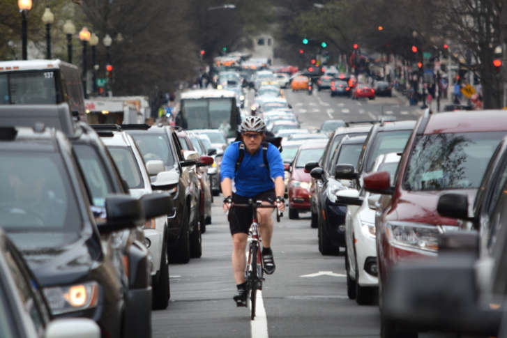
Okay, to the photo above is a joke--in terms of cycling but not, of course, to the poor souls rotting in their tin cans.  On this tour, I encountered a wide variety of conditions, and I wanted to recap and detail what I encountered for those who may want to follow in my wake.

First of all.  DON'T DO IT.  At least the exact route I took.  Let me explain.  Most of the tour was good, often excellent riding, but about 20% should for sane people be a no-go-zone for cycling. Here are the different sections and what to expect.

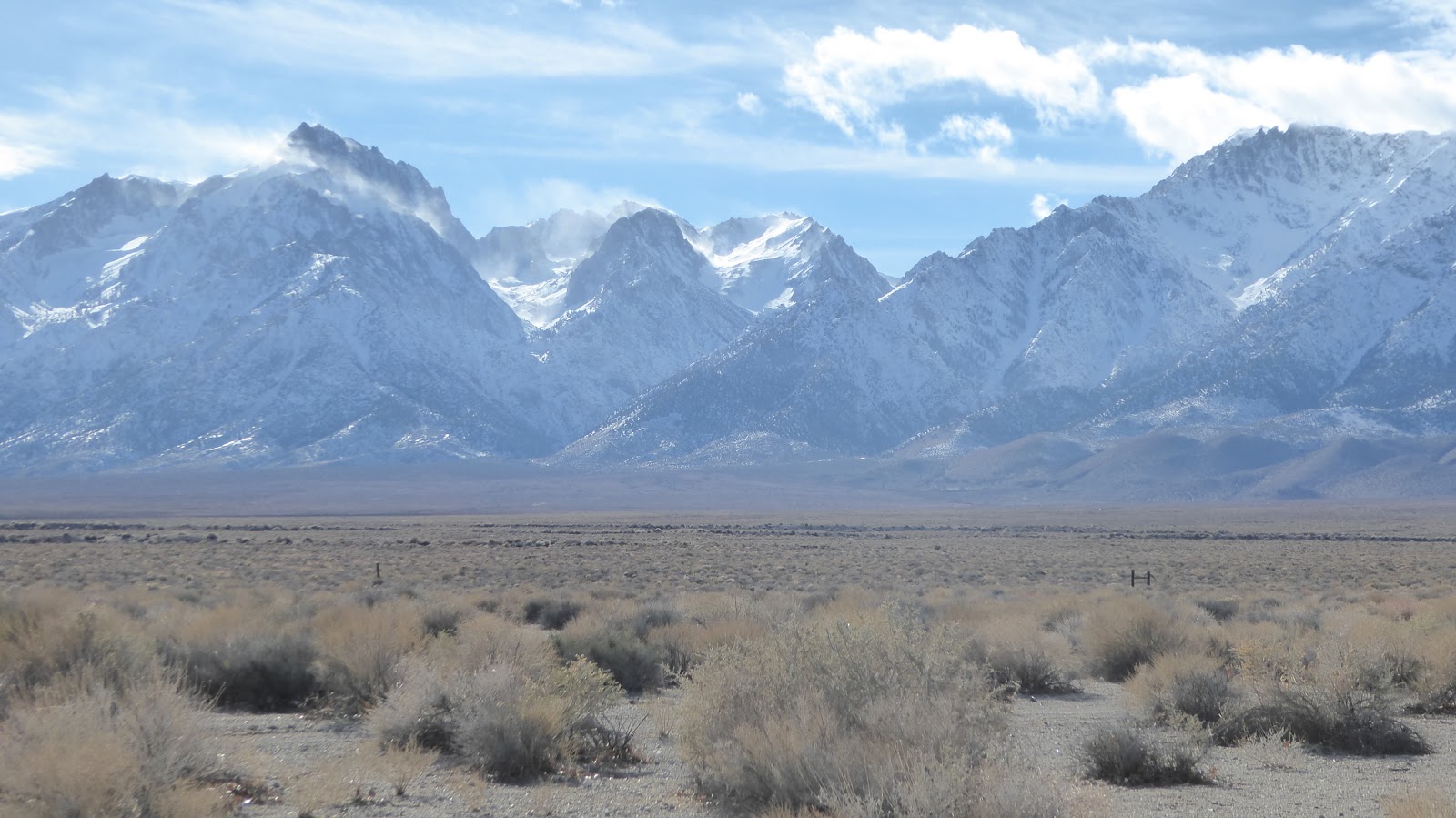
Hwy 395:  From about Ridgecrest in south almost to Bridgeport in the north, 395 offers double excellent cycling--often divided, double lanes, fat, fat smooth shoulders.  One section north of Bishop was chip sealed some time ago, but most of the rest is wonderful.  Traffic is moderate to light.  Full services in Bishop, including bike shops.  The other little towns offer a lot, too.

Death Valley:  This is world class, do-it-before-you-die road riding.  All the major routes have good to excellent pavement, and the only commercial trucks are smaller ones there to service the few concessions in the park.  The main considerations, if you have the flexibility, is to avoid peak visitation periods.  Avoid Christmas to New Years and any long holiday weekends during the cool months.  Spring seems to be more popular than fall.  I've pedaled through during a cool spell in March, but mostly I've toured in mid-winter.  Personally, I wouldn't want to ride there when temps get in the 80's, but, of course, each rider must choose her own conditions.  For me, the no-go months are generally April through October, but obsessive weather site study can reveal windows when the riding can be good. On a long tour such as this one, Death Valley is only one of several warm/hot zones, so going at the right time of year is critical.  The store at Stovepipe has minimal supplies--but you can get some brews.  Restaurant and lodging are available for those who don't want to camp.  Furnace Creek has a better store.  Texas Spring is the camp you want--no generators allowed.

Death Valley Junction to Baker:  More great riding here, but there are some important considerations.  The ride from DVJ south to Baker is good riding, but traffic once again becomes an issue.  Although not extreme, truck traffic makes an appearance.  The road has no shoulder, and the volume of traffic seems to have increased since my last tour through the area.  Riding it early in the day could help.  If you blast through from Furnace Creek, this won't be possible, however.  You can stay at the Amargosa Hotel or camp in that area.  You'll want to camp at the RV park in Shoshone for sure, which is the last supply point before the dry run to Baker on Hwy 15, about 60 miles south.  Critical issue!  Ride the stretch from Shoshone to Baker ONLY Monday through Thursday, and possibly avoid those two days depending on the timing of any long, holiday weekends.  You will ride by the Dumont Dunes off-road recreation area, which sees extreme traffic on weekends and holidays, vast streams of RV's, campers, huge trucks with "toy" haulers, etc.  Under no circumstances do you want to deal with those people on top of whatever truck traffic might be using the road.  On several tours, we've hauled our dog with us, so that meant camping in the vicinity of the Amargosa Hotel and again about half-way between Shoshone and Baker.  These camps necessitated hauling water.  Most cyclists will have no problem avoiding these camps. Baker has a crappy market and a stack of convenience stores.  The best supply store is the Mexican market next to The Mad Greek restaurant, the best place to eat.  You can get tasty gyros and salads.  We've stayed once in a motel there--NOT great.  Ever since, we've loaded up with water and pedaled a few miles into the East Mojave Preserve to throw down for the night.  This is a great option.  I suppose I might stay in Baker again if there were some sort of extreme wind event.

The East Mojave Preserve:  As the blog describes, the "pavement" here used to provide the tortures of the damned, but it has since been "up-graded" to serviceable chip seal.  I don't know how many years this will last, and cracks and potholes are already beginning to show, but it's okay for now.  Leaving Baker, you'll have water ONLY at Kelso until you get to Fenner way out on Hwy 40.  Our strategy has been to crank from Baker over the long pass, drop down to Kelso, water up, crank a bit south and camp off a dirt road on the climb to Granite Pass.  You'll find the road about 5 miles south of Kelso, give or take.  This is spectacular riding, but, alas, I've got some bad news.  On weekends, thanks, I'm sure to the glories of Google maps, traffic will appear starting in Kelso.  Drivers coming from the south, off Hwy 40, are now using these once virtually empty roads as a shortcut to get to effin' Vegas.  The stretch from Baker to Kelso was basically deserted, but once I hit the intersection at Kelso, the cars just kept coming.  Amazing.  I dropped in on a Friday, so the bulk of the traffic was south to north.  I left the area on a Sat., and traffic was lighter but still present.  I suspect that climbing out of Kelso on a Sunday might be unpleasant.  So, once again, I suggest careful timing for the best riding conditions.  Plan layovers and rest days, if possible, to be riding through the East Mojave between Monday and Thursday.  If you ride Shoshone to Baker on a Monday or Tuesday, that should do the trick.

Hwy 40 to Needles:  Once you crack Granite Pass--spectacular!--you get a nice drop to Hwy 40, although if you are continuing south to 29 Palms, the drop is truly staggering.  For this tour, I was headed east, so Interstate 40 it was.  The riding, however, was excellent--with the qualification of the traffic noise.  The shoulder is wide, very smooth, and fast.  Bring good earplugs to deaden the sound, and you'll be happier.  Cyclists can camp for free and get brews/convenience store food at Fenner.  I got back on I 40 in the morning for the run to Needles and was directed to leave the highway at Goffs Road.  While this will take you back to Rt. 66 and seemingly good riding, it requires you to get on Rt. 95 to drop back to I 40.  As I've explained before and will again Rt. 95 SUCKS!  Huge fast traffic, no shoulder.  Don't do it.  Stay on I 40 for a couple of mild climbs then a many mile sweet roll into Needles, a crusty desert town but with all the usual amenities.  The Motel 6 is cheap and clean.

Needles to Lake Havasu City:  A quick study of the maps will show you a good way to get over to Rt. 1, a "scenic" road that, alas, has more traffic than I remember.  Rolling climbs, chip seal, good views but compromised due to traffic.  You'll land on Golden Shores and quickly pick up Hwy 40 again.  About the first mile, give or take, on I 40 will leave you wanting to quit the tour, but the shoulder does improve substantially.  The run from I 40 to Lake Havasu has a rough shoulder to start with, but after you top a long mild grade, the descent to the town is GREAT!  Big, big fun.  As I describe in the narrative, jump on the multi-use path as soon as you see it.  You won't be sorry.  ALL services available, including bike shops.  Wild BLM camping available in SARA park, just across from the end of the bike path--climbing all the way out of town.

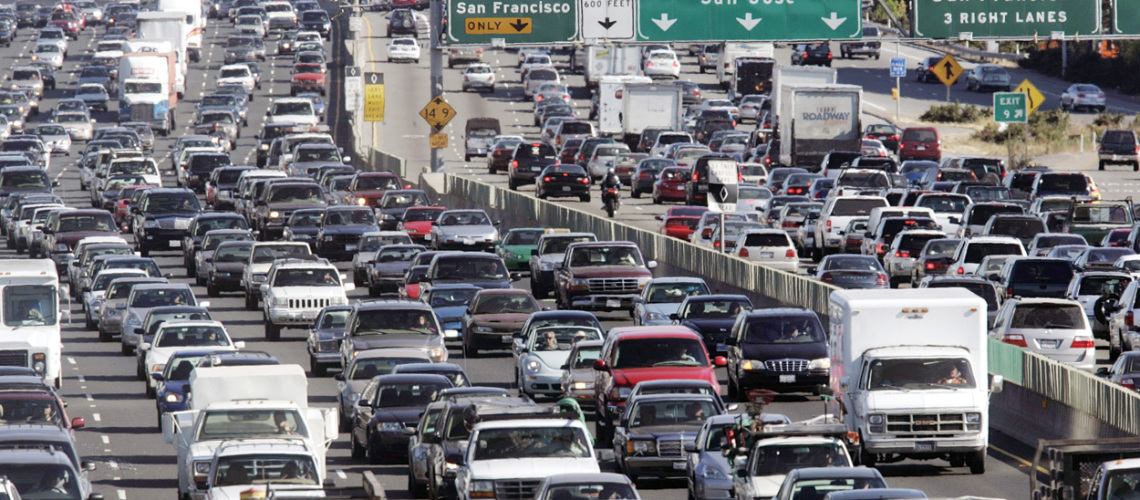
Lake Havasu City/SARA Park to I 10 cutoff/Hope:   This is the world of suck part of the tour that will keep me from ever riding this route again.  Fifteen years of development and population growth and a corresponding lack of ANY road improvements means that you should avoid this section.  It just flat-out sucks, and I see nothing on the horizon to improve it.  Now, one option--not a bad one--would be to rent a U-Haul and simply motor this stretch.  There is a neighborhood U-Haul dealer in Salome, which is on Rt. 60, after the road improves.

Hope to Prescott:  While the riding from Salome to Congress is boring, the traffic is generally quite light, and there is a decently wide shoulder.  It's pretty rough, but I found that I could usually ride in the lane and bob over as traffic approached.  Congress to Prescott is some of the best riding of the tour--simply spectacular.  It's a big day, however, so be ready for a fight, 4,600+ feet of elevation gain.

Alternate Route:  For those who'd like to pedal all the way, the best option would be to pick up Rt. 66 east of Needles and climb through Oatman to Kingman and take the Mother Road all the way, basically, to Ashfork and Hwy. 89.   This would be a great option.  You miss the Sonoran Desert, but the riding works for us cycle touring folk.  A couple of considerations: One, you will be above 4,000 to 5,000 feet for a few days, so timing is critical.  Mid-winter CAN be okay, but a big storm could ruin your tour.  Pick a good weather window (cold nights/mornings!) or go in a slightly warmer period, say November or March.  I've ridden this section east-to-west in 2007, and it's pretty good.  Traffic becomes and issue as you head south on 89 towards Prescott, although there will be a shoulder most of the way or double lanes when there isn't.  From about Chino Valley south, commuter traffic appears in the mornings/evenings.

Overall, this is remote riding, so be confident in your gear and ability to effect road-side repairs.  I would consider this somewhat advanced-level touring.  It's not outer Mongolia, but it is about as remote as one can get on paved roads in the USA.  Ride accordingly.


Monday, February 4, 2019

Day Sixteen: Out of the Desert, Into the Mountains


Day Sixteen: Out of the Desert, Into the Mountains
Miles:  43.67
Climb: 4587--Ouch
Ave. spd.: 7.3 mph

Total Tour Distance (drum roll): 695.28 miles--Let’s round it to 700, eh?

No rain during the night, cloudy as promised, no wind.  It was perhaps my warmest morning of the trip-- 53 deg. F., but because of the altitude change, it would be my coldest day overall.  After the trauma south of Havasu and the tedium of Rt. 71 and 60, I was itching to get after this most challenging day. Shortly before 7AM, I was reaching for the sky, digging into the Yarnell grade.


With no commercial trucking to speak of, double, mostly divided road--the downslope route hanging sometimes far above and out of sight--I climbed with light traffic and a fat, usually clean shoulder.  The dusty green of saguaro, creosote, prickly pear and acacia fell away, the damp grey of the building storm hanging low, obscuring the mountain tops above me. This was class A cycle touring and a much needed antidote to the previous days.  While the gentiles considered this climb shocking, to a well-tuned cycle-tourist, it was straight forward ascent, a steady 4--6%. I estimated two hours but topped it in 90 minutes.

As I climbed, the tragedy that played out in the mountains a few years ago ran sharply through my mind.  The Yarnell fire claimed the lives of 19 brave men and women, true heroes who, unlike the millionaire Colin Kaepernick, actually did risk everything and lose everything.  The loss of these Granite Mountain Hotshots hit Prescott like a bomb. Almost everyone seemed to know someone directly or indirectly connected with the catastrophe. Although I’ve never been a firefighter, I have friends and family members who have done such dangerous work, and somehow, as an adventure fanatic and wilderness traveler, I felt a kinship with these people.  I imagined their moving downhill, gauging the fire, fixing on the cleared area below that would offer refuge, pushing hard, exhausted, hot, the ache in their legs building, realizing, at last, desperately, that the fire was faster than they were. They worked frantically to clear an area, deploy their fire shelters, and hunker down, hoping, probably shouting encouragement to each other.  But the flames cared nothing for their hopes, their families, the lives and dreams they carried. The fire took them all.

I thought about all this as I pedaled by the memorial park developed in their honor.  We owe so much. My own efforts seemed meager.

And suddenly, the town.  Because of the story of the fire, I expected some sort of devastation, but the line was back from all the residences, and the rocky slopes had begun to recover.  It looked much as I’d remembered, a quaint little town perched on the edge of a desert precipice. Cool, upper 40’s, for once a snappy tail wind, I wolfed down a snack and launched, ripping through town and out in a blaze of triking glory into the Peeples Valley, the pavement dreamy smooth.  Well earned easy speed and miles left me laughing again. Booyah!


Grey, low-hanging skies ringed the dry grassy valley. In the distance, I could see patchy snow up in the pines.  This was no summer ride. I rolled and climbed, broke through a fierce little ramp and faced a tedious traverse to Wilhoit, a small cluster of homes at the base of the steeper terrain above.  Miles of slow grinding ensued, the clouds building and pushing lower. A couple of road cyclists with bikes that weighed less than one of my panniers blasted by. As I hit Wilhoit, the rain started.  

Okay, so the rain wasn’t going to hold off.  I pulled under an empty carport next to the local market, slipped plastic bags over my socks, donned Gore Tex, choked down a Clif bar, and set out.  I gained some altitude, hood pulled over my helmet, but it wasn’t long before the rain stopped, and as I’d expected, I began to overheat. Off with the rain gear, back to the climbing.  Twist and turn, climb and spin, reel in those ponderosas, Scotty.  Each moment yielded a new vista, a break in the clouds, another valley.  I caught a delightful descent, passing two different roadies paused on the side of the road.  Of course, the drop meant more climbing, but the cool air rushing by, the short escape from the relentless pedaling, gave me energy to continue.  Having curves and switch backs tightly spaced gave my slow climb a sense of progress that the interminable desert grades usually lack. There is something intrinsically heartbreaking about staring straight into the barrel of a ten mile grade with not a single curve to distract the senses. This was hard work, no doubt, but I was a man happy in his efforts.


At one point, I paused to escape the leg burn and gather forces for the next assault when I saw a line of sportscars gunning up the road--another gang of drivers!  How strange to have my tour bracketed in this way. As it began, so it shall end. This, however, was a lower rent driving club--Subaru’s, a couple of Mustangs, a VW Golf.  Nice enough, but these weren’t no Porsches or gull-wing Mercedes. The hot-blooded young men were hampered by a low speed limit and slow traffic, their intense expressions locked on the road as they jockeyed for the front of the line.  I thought of the shattered railing I’d seen, the white crosses I’d slowly passed, the arms inscribed with the names and short lives of young men who were certain their nerve and skill were up to the task while physics had other plans.  I suppose there is some Darwinian value in the daring of young men, but it doesn’t always end well.

The roadies soon caught up, and for a while they slowed their pace and asked about my journey.  Many years had passed since I climbed this pass, so I asked, “So, we’re near the top?”

“Not quite,” said the one on the red carbon fiber machine. “You’ve got five miles, mostly climbing.  We call mile marker 305 the summit.”

“Oh, thanks,” I replied, my heart sinking a little. That could easily mean another hour of climbing.  I was a horse tasting the barn at this point, but the fresh oats would have to wait. My featherweight brethren wished me well and quickly vanished out of sight.  You’ll get there, Scotty.  One pedal stroke at a time.

Round a corner--as descent!  Another climb. Mile marker 301, 302, 303, 304...305.  Victory! A sign just ahead proclaimed 6,100 ft. of altitude.  I took another photo of the trike and my own grinning mug and got ready for the drop to town.

Only to find myself a grinning sucker.


A short, mild drop led to ANOTHER climb.  What-the-what? This was not right. Not right at all.  The bastard roadies had sandbagged me. Gear down, keep at it.  Finally, another summit, this higher than the previous, and unmarked, was, indeed, the last true top of the hill.  I eased over the crest and slalomed through a set of juicy curves, excited that I was almost done. The final street, of course, had some climbing I didn’t remember, but I knew even so that I was close, so close.  There. Turn, flat, coast, park. Done.


The human powered segment of my journey was over, and after perhaps a decade--could it have been so long?--I would get to meet my old friend once again.

I unhitched the bags from the trike, schlepped my gear into the house, and once more took a Shower of the Gods.  It was so good to be here, and the warmth of success soaked into me with each moment under the hot water.

Friday, February 1, 2019

Day Fifteen: Grinding It Out


Day Fifteen: Grinding It Out
Miles: 60.4
Climb: 1432
Ave. spd.: 9.5 mph
Total miles so far:  651.61

Coyotes yip and howl beyond the acacia screen to the south.  To the east, down the hill, a freight train groans upstate. Noisier than I’d like, but this funky camp behind a saloon and restaurant will do the trick.  I had no idea I’d end up here when I started out, which is often how the touring game is played.

Forty-one degrees F. and damp when I clawed through the nylon door of my little tent at 5AM.  A perfect crescent moon hung low in the sky, a blazing planet keeping it company. Venus, right?  I crunched out the gravel drive of the KOA shortly before 7AM, the shadows long. Today, I knew I had a shoulder most of the way, so I could relax, especially since Rt. 60 is not a heavy trucking route.  The big challenge today was just keeping the motivation going as in almost sixty miles there would be about four turns.

Some agriculture appeared to the north, and tell-tale tufts of cotton on the road suggested the crop.  To the south, creosote, cacti, and steep mountain ridges. Salome seemed dead or in hospice care, the RV parks barely holding it up.  I could find no general store, just lots of blistered paint and some shuttered businesses. Further down the line, Wenden had some life--a neat coffee shop and artists’ square.  I hope it can hang on. Beyond Wenden, the only development until Aquila was a couple of RV parks.

I need to research the numbers, the economics of the snowbird/RV’er phenomenon in Arizona.  It is truly staggering. Refugees from Washington, Idaho, Montana, and Wyoming and elsewhere come flooding in.  Near towns, many open plots of land are scattered with RV’s and fifth wheels. Quartzite is the king, of course, with thousands converging there every winter, a veritable ocean of RV’s.  This is all negatively impacting bike touring, of course. With so few road choices across vast tracts of land, all the traffic gets concentrated. No bueno.

Still, Rt. 60 was a huge improvement over 95 and 72 of the day before, so I cranked out the miles, breaking at the end of 10, then 20 miles, but a little more frequently thereafter as I developed an aching IT band and left hip.  Need to work on that. The shoulder, while wide, became cracked and littered with gravel after the first 8 or 10 miles, so I rode in the traffic lane, watched my mirrors, and bounced over to the shoulder when necessary. Occasionally, I’d just let the driver take the other lane because the traffic was so light.  

At 40 miles in, I broke for lunch, peeled off my top layers, and basked in the perfectly warm late January sun.  The temperature was ideal--Goldilocks’ temps.

The chip seal began to sap my motivation, but I slogged on, mile after mile, breaking now and then to stretch and cool, able now to enjoy the huge saguaro cacti and the fearsome cholla.  Puffy white clouds drifted lazily across a sky of deep blue. This was perhaps the finest day of the tour.


With virtually no downhill runs but a few moments before and after Congress, every mile was earned by the spinning of the pedals, another six hour spin class.  I imagined for a time I might take on the big grade to Yarnell, but as I finally made Congress, that was no longer on the menu. I needed to stop pedaling, and the first big grade looked like a two hour job, and eight hours tied to the mast didn’t seem worth it.

A few groceries then up towards the mountain to get some water at the Arrowhead Bar and Grill.  There I met friendly people who were eager to help. As a young man filled my water bag from the bar, I told him about my journey, and Chris, who turned out to be the owner, was really excited about it, wishing the regular bartender, who is a cycling nut, was there to see me.  I showed Chris my weird trike to good effect, and as I described my plan to ride up and find a place to camp, He quickly offered me the back property behind the restaurant. Done! He walked me around the back, down between some abandoned cars and long out of service trailers, and there I pitched camp.


So here I sit in the dark with a good threat of rain for tomorrow.  A week out, forecasters had been pegging the chance of rain at 100%, but now it’s down to scattered showers, starting late morning and backing off in the afternoon, about 40%.  The ride could get interesting, but I’ll take this change. I had been obsessing about the forecast, looking at that 100% number like a man going to his doom. Well, the only gear I’ve carried that I haven’t used is an extra pair of cycling shorts and my rain gear. Time to check off one more item. I’ve rigged the panniers for rain, put the seat cover on. I’m ready.

So I’ve had my last meal of the tour, pitched my last camp, and a ride of nearly 700 miles will end tomorrow with over 4,000 ft. of climbing, my biggest day.  End it with a bang--or a squishy, cold crank. I’ve got plastic bags for feet and hands and rain gear to cover everything else. I’ll get through. No choice.