
From the start, as a teenager, I thought of myself as a mountaineer. It was the high, snowy peaks that captured my youthful imagination. Living in coastal California meant that most of the time I was climbing on small rocks, but eventually I made it to the high peaks and scaled my first alpine summit when I was 16. In these hyper-protective, "safe space" times, it's hard to imagine parents letting their children with newly minted driver's licenses out on the the highways and into the wilderness on their own, but it seemed normal at the time, although I'm sure my parents had their worries. They understood, however, that to grow we needed to take on genuine challenges. I'm grateful for it every day.
With so much great rock to climb, however, and other interests and responsibilities, we drifted away from climbing big peaks. Cycle touring, a dog, the usual suspects left the big boots, crampons and axes in storage. It was time, however, to dust them off and head into the back country. Pictured above, Red Slate Mtn., 13,140 ft. high, was to be my objective, a peak I'd climbed a couple of decades ago via the obvious and compelling gully that diagonals across the face. I wanted to revisit that experience. On a bright July morning, I hoisted my 45 lbs. of battle rattle and headed up the Convict Creek trail.
Day One:

Less than a hundred yards from the car, the sternum strap on my pack popped off. What the hell? For a little bit of strapping and a small buckle, this is something of a critical piece. No way was I scrambling and hiking without it. After some cursing, cutting my finger with a knife and generally failing to reattach the clip to the piping on the shoulder strap, I ran back to the truck and scored a mini-'biner that finally did the trick. In less than 15 minutes, the frustrated mountaineer was back on trail and trudging into the shadowed canyon beyond.

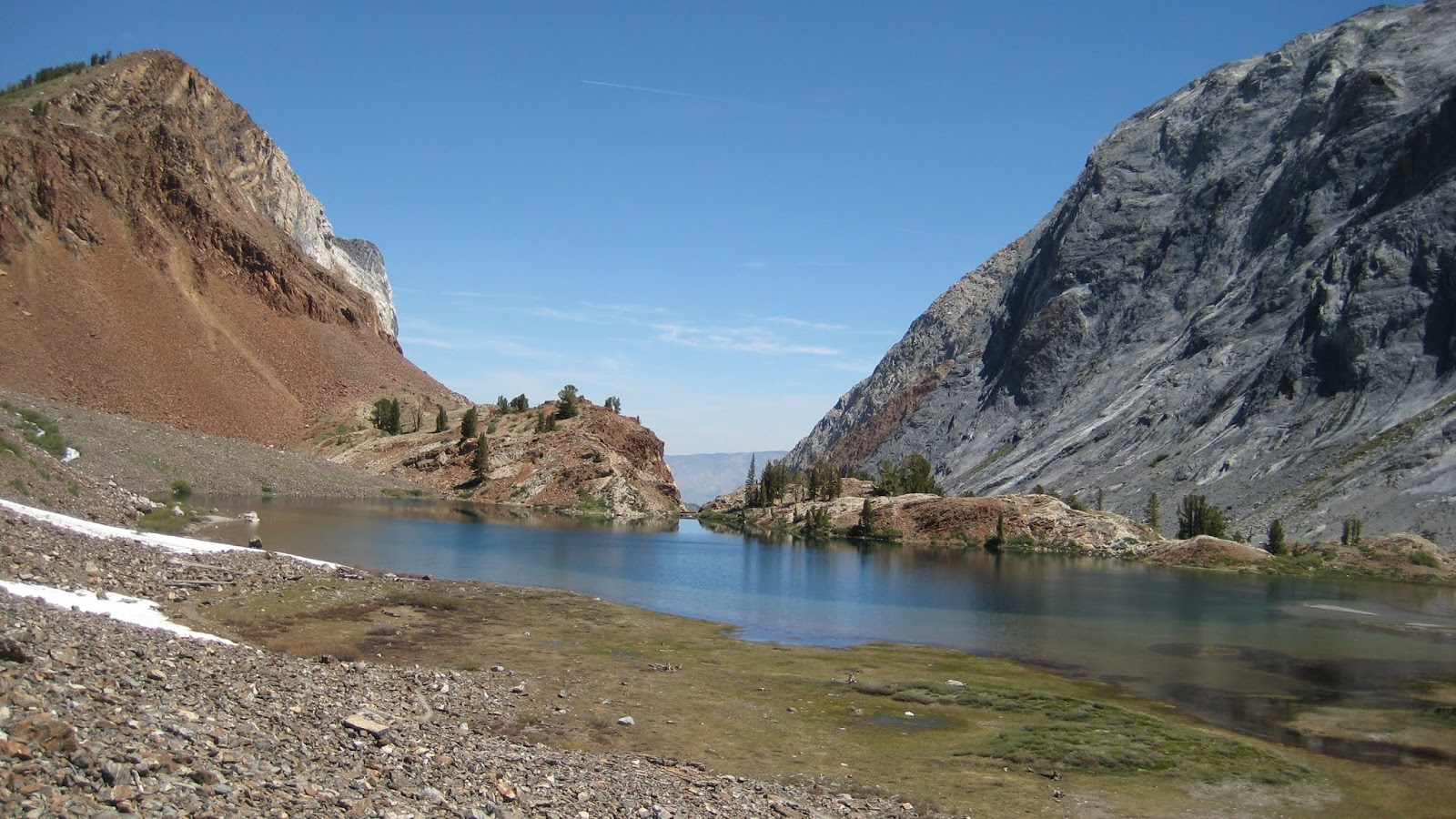
Red Slate appears up canyon.

The stunning limestone walls of Laurel Mtn.

Wild flowers lined the trail.

Land slides and erosion often obscured the route.


As I ascended, the roar of the creek and the stunning white water didn't fail to make an impression. Key to my success was being able to cross the creek, and I had tried to mentally prepare myself for retreat if it looked too dangerous. Before long, I was deep into the canyon and nearing the crossing.
Looking down canyon:

Somewhat cowed by the impressive sounds and sight of the rushing confluence of Convict Creek and the equally impressive flow from Lake Genevieve to the north, I dropped my load to evaluate my options.
I turned and as if transported there by the Starship Enterprise, I see this dude:

I called him Mr. Sketch. He must have slipped in behind the old bridge support I was sitting on while I was gripped looking at the creek. He did NOT look solid. I watched him teeter from rock to rock, struggling to balance with his massive stick. I got busy putting on my neoprene booties for my attempt.

I hoisted my load, leaving everything unbuckled in case of bail out, and proceeded to cross Genevieve creek first, the water rushing up to my knees and beyond as I plunged my legs into churning holes where I could not see the bottom. The booties did the trick, keeping my feet warm and providing grip, although the sharp edges of the rocks were uncomfortable. With each step I struggled to find a solid wedge for my feet. Quickly, I got to the other side and joined Mr. Sketch as we moved up stream to find, we hoped, a better way across the a main flow. I went first, leaning hard at times on the trekking pole, fighting dizziness from the rushing water, struggling here and there to maintain balance, leaning into the flow, working for precise footing with blind placements, the flow sometimes up against my thighs in the deepest holes. In moments, however, the deed was done, and I stood safe on the rubble-strewn southern bank.

I looked across at Mr. Sketch and gave him the cutting gesture across the throat--no go, amigo. I didn't trust him to pull it off. Prudence being the better part of valor, Mr. Sketch heeded my advice and retreated. I watched him carefully until he was back on firm ground. Excited now for the way ahead, I saddled up and forged up canyon. After so many years, I had virtually no recall of the details, and it was as if I hiked it for the first time. Ah, the benefits of a crappy memory.
The canyon is nothing short of stunning and one of the best in the Sierras--or anywhere. Giant limestone walls, a raging creek with scary snow bridges that only a fool would try to cross, snowy mountains up ahead. Scotty found his happy place.


At last I broke through to the upper canyon and got a good view of the peak.

And then even better from Mildred Lake:

The trail skirts the eastern end where this glorious bridge awaits. Good thing, because falling into the creek at this point would mean certain death. So glad I didn't have to shimmy across that log. It's pretty lightly attached at the far end.

View from the far side of the lake before a hot, brutal climb:
At last, over 7 miles and about 2,800 feet of climbing, Dorothy Lake, where, indeed, you are certainly no longer in Kansas--but as close to Oz as I ever expect to get in this life:

My humble one person abode where I spent some happy hours resting, reading, and contemplating the next day's hooliganisms.

It turns out that my chosen route, the big diagonal couloir, was in abysmal shape--a big, nasty melt groove in the lower half, loads of obvious rock fall damage--totally nasty and not worth doing. Plan B? The face to the right, facing northwest, had almost continual snow all the way to the summit, and it looked pretty steep at the top, at least the equal to the couloir, maybe steeper. That would be my line. Here's a pic with the line drawn, the photo from the next morning's approach:

That decided, I settled into domestic life, eating up the pages of Stephen Ambrose's D-Day and listening to the occasional fusillade of clattering stones as they rained down from the crumbling wall across the lake, a good reminder to choose my routes wisely. Finally, it was time to cook my regulation pasta meal on my most proud piece of outdoor gear: My home made Pepsi-can alcohol stove:


Kick back and relax in the cool evening--virtually no mosquitoes, bros!

Day Two:
I slept surprisingly well, rising once at 2AM, then getting up for good at 4AM, scrambling out into the 40 degree morning to brew up coffee and choke down a bowl home made oat cereal. The anxiety of anticipation coursed through me as I hustled to get out of camp, finally clumping down the trail at 5AM, the east starting to glow through the trees. I hadn't seen a soul since the creek crossing the day before. I felt as if perhaps I should have started earlier, but route finding through the trees and rumbled topography between the lake and the peak was definitely improved by a little alpen glow as the morning progressed. Snow covered many portions of the route until I was dead reckoning up a class four headwall and along forested ridges until I was clear of the tree line not long after 6AM, the peak above burning with the morning light.
Although I'd done a couple of training hikes with a load and the boots, there is always an adjustment period to wearing these 2X4's strapped to your feet. Awkward, a bit of stumbling here and there, these old Sportivas are, however, spectacular boots and virtually never give me blisters. But they're pigs-- 3 lbs each! Add some stiff crampons, as I did once the snow slope started to get serious, and yer swinging a real load with each step and kick. Hard work, this.
Seven AM, crampons and heading up!


The snow, to put it bluntly, was fucking fantastic. Rock hard, providing a great purchase for crampons, indeed, making them absolutely essential once the angle increased. I carried two ice tools, although one would have done the trick. The upper headwall, however, would provide enough interest to make a second tool nice to have. One big advantage of my route choice was that its NW aspect meant solid shade for my entire ascent. In the photo above, I gunned for the shaded left side, rounded the corner and headed straight for the top.
Views NW after cresting the first snowfield:

Looking back down canyon:

From here the route steepened. I felt the altitude start to kick me in the ass. But I did my best to maintain a steady pace--tool, front point, side step, tool, side step, front point, tool. And on and on. Occasionally, I'd get a recess to rest in and ease my throbbing calves. I couldn't believe my luck on the conditions. Snow so hard you could front point! Jamming in the ice axe shaft was out of the question--unless you wanted to hammer the shit out of it. I charged up, gasping, focused, alive. Before the steepest section of the wall, I came across a series of animal tracks cutting across the slope. What the hell creature was this?

Each print was roughly the size of my palm. Astonishing. I thought of those classic lines from Hemingway's The Snows of Kilimanjaro: "Kilimanjaro is a snow covered mountain 19,710 feet high and is said to be the highest mountain in Africa. Its western summit is called the Masai 'Ngaje Nagai,' the House of God. Close to the western summit is the dried and frozen carcass of a leopard. No one has explained what the leopard was seeking at that altitude." I shook my head and got after it, the wall impressing me with the seriousness of my task. The climbing was not technically difficult, but I was all by my lonesome in a definite "no fall" zone. A slip would mean a grotesque slide, the catch of a crampon, a full-on tomahawk flipping nightmare with six broken femurs. Focused, methodical, one step at a time gets it done.


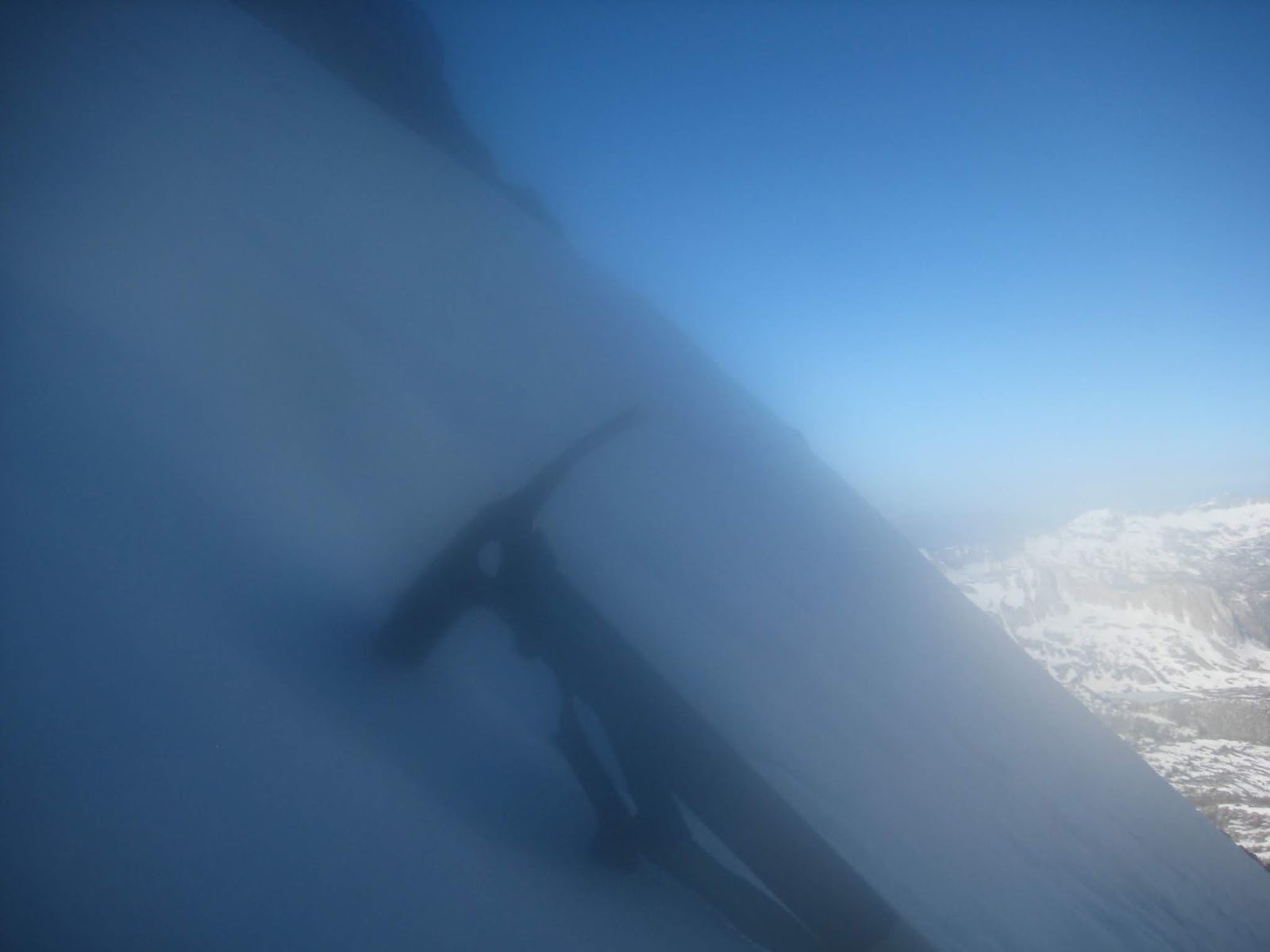
I held the camera for a moment in my mouth, which resulted in these weird "mood" shots:

I found that if I put some stank on it, two or three kicks would give me a mini-step about three or four inches deep, so I didn't have to front point the whole way up the last pitch. Nice. Before long, I left the snow, took off the crampons, stowed the axes, and scrambled in minutes to the top, less than four hours after leaving camp. Happiness!


Summit Clif bar shot for Tom Grundy:

I lingered for about 45 minutes on top, contemplating my life and ascents, the twenty years or so since I last stood here, also alone. I thought of my first alpine summit forty one years before. I thought of Jodi and home and the need to get down. Getting to the top is only half the job. It ain't over til yer slammin' beers, so to speak.
On my last ascent, I'd boot skied for much of the descent, but it couldn't have been the way I just came up--too steep. I peered over the more western slope and saw the way--all scree and talus this time without a spec of snow to be found. Amazing. But it looked easy and safe. I loaded up and cast off, sometimes sliding down a couple of feet for every step--easy and fun. I danced with the angle of repose and stopped to photograph the amazing high altitude flowers.
I headed straight down then cut right to the snowy shoulder to re-gain my ascent route below the steep snow.


Fun to come down, a slogging nightmare to ascend. Choose wisely, Grasshopper:

All that remained was plunging down and a hot slog back to camp. I took one last parting shot from the lower snowfields. By enlarging the photo and looking closely, you can see the deteriorated condition of the gully, looking especially steep because of the head-on view. No more ascents this year. No bueno.

As I ambled the last mile back to camp, I encountered a young woman, a goddess to greet me on my return from Olympus, er, Red Slate. She smiled and was interested in my ascent. I was surprised to see anyone after my creek crossing stress. Or was I hallucinating? Was I alone and merely talking to myself? Who can say. I bid her good day and did not see her again. In camp, I lounged and read, brewed up some afternoon coffee and enjoyed the shade and mosquitoe-free hours before sunset, the shadows growing long, a breeze sighing through the stunted alpine forest. Good times, this.
Day Three:
Although I wasn't thinking about it at first, I was clearly a little worried about having to recross the creek. I packed and drank coffee and started out, skipping breakfast. I wanted to maximize my time hiking in the shade, and maybe the creek would be lower earlier in the day. I ended up getting to the crossing at nearly the same time as the way up. Creek was just as noisy and intimidating, but I got across just fine. Here are some photos from the way out.


It was Friday as I descended back to 7,600 ft. at the trail head, and the weekenders were on their way in, a few backpackers among them. I gave a warning about the creek and wished them well. I was a happy fool to have it behind me. Before noon, I dropped my pack at the truck. Sandals and AC for the drive home--yay! Another adventure in the bag.
For your edge-of-the-seat viewing pleasure, I give you Chris Labounty, a brave wingsuit flyer who did the first (only?) flights off Mt. Morrison and Laurel Mtn. Don't do this at home, kids. Or anywhere else. Chris died wingsuit flying not too long after this video came out.
Ghost Riders in the Sky